News Summary
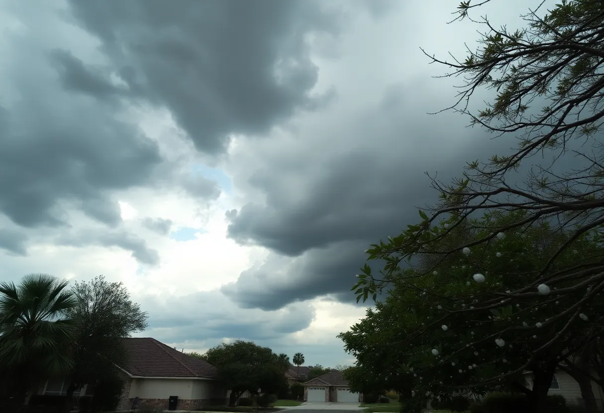
On May 2, 2025, San Antonio was struck by severe hailstorms, resulting in significant weather impacts across the region. Reports indicated varying hail sizes throughout nearby communities, with incidents of lightning-related fires and flash floods. The National Oceanic and Atmospheric Administration (NOAA) issued warnings of severe storms affecting areas beyond Texas, signaling a potential threat to millions. Officials continue to monitor the situation closely as locals share their experiences and safety remains a priority amid ongoing weather challenges.
San Antonio was hit by severe hailstorms on Friday afternoon, May 2, 2025, resulting in significant weather impacts across the region. The storms, which led to viewer reports of varying hail sizes and an incident of lightning-related fire, affected numerous nearby areas including Bulverde, Spring Branch, and Cibolo.
Residents across these communities experienced heavy hail showers, with some reports indicating pea-sized hail in Cibolo and varying conditions in Bulverde and Spring Branch. These storms also brought rain and dark clouds to Boerne, where rain was visibly approaching.
As the severe weather unfolded, a viewer from Garden Ridge reported a fire caused by a lightning strike on an oak tree shortly after 5:00 PM. The strike occurred while a viewer was filming the rain from their garage, hitting a tree approximately 75 feet away. This incident highlights the dangerous nature of the storms affecting the area.
In addition to the local hail and lightning incidents, severe storms were reported across Oklahoma and Northern Texas, impacting an estimated 113 million people. The National Oceanic and Atmospheric Administration (NOAA) issued a Level 3 out of 5 risk for severe storms stretching from San Antonio to Nashville, Tennessee, and into central Kentucky. This risk category indicates a higher likelihood of severe weather, including strong thunderstorms.
The storms generated wind gusts reaching up to 60 mph in locations such as southwestern Kentucky and northwestern Tennessee. Furthermore, a tornado was reported to have touched down in Burnet County, Texas, resulting in injuries and damage to homes, emphasizing the severity of the weather conditions.
Dallas also faced significant rainfall, accumulating 2.4 inches on Thursday, shattering a historical daily rain record that dates back to 1905. Following these intense storms, flash flood warnings were issued for southern Oklahoma due to considerable flooding that disrupted road access to Blanchard, Oklahoma.
Additional rainfall was projected for Friday, with forecasts suggesting another 1-2 inches could fall during the ongoing storms. A Level 2 out of 4 threat of flash flooding was established through Saturday morning, affecting regions across Texas, Oklahoma, western Arkansas, and Louisiana, warning residents to remain vigilant.
With severe storms on the horizon across the Ohio Valley and Northeast as well, there is potential for damaging winds and large hail beyond the Texas and Oklahoma areas. This extensive and active weather system may hinder ongoing recovery efforts in areas of Pennsylvania still dealing with the aftermath of previous severe storms.
Viewer engagement was encouraged, prompting local residents to share their experience by submitting photos or videos of the storm impacts to further document the weather conditions through various community platforms.
As the situation continues to unfold, officials and meteorologists are closely monitoring the ongoing storm threats to ensure public safety and preparedness in the face of these extreme weather events. Residents are advised to stay informed about the latest forecasts and heed any emergency alerts or advisories issued by local authorities.
Deeper Dive: News & Info About This Topic
HERE Resources
Severe Thunderstorm Watch Issued for San Antonio
Fiesta San Antonio Celebrations Continue This Weekend
San Antonio Prepares for 134th Battle of Flowers Parade
2025 Fiesta Pooch Parade Set for May 3 in Alamo Heights
Casting Calls Announced for Aspiring Actors in San Antonio
San Antonio Faces Rainy Weekend for Fiesta 2025 Events
Severe Weather Alert: Tornado Risks Extend Across Upper Midwest
San Antonio Weather Update: Mild Week Ahead
San Antonio Weather Update for Fiesta Weekend
San Antonio Kicks Off Final Fiesta Celebration
Additional Resources
- KSAT12
- Wikipedia: Hailstorm
- KENS5
- Google Search: Severe Storms Texas May 2025
- San Antonio Express-News
- Google Scholar: Hail Damage Texas
- KENS5
- Encyclopedia Britannica: Weather Patterns
- KSAT12
- Google News: Hail Storms San Antonio

Author: STAFF HERE SAN ANTONIO WRITER
The SAN ANTONIO STAFF WRITER represents the experienced team at HERESanAntonio.com, your go-to source for actionable local news and information in San Antonio, Bexar County, and beyond. Specializing in "news you can use," we cover essential topics like product reviews for personal and business needs, local business directories, politics, real estate trends, neighborhood insights, and state news affecting the area—with deep expertise drawn from years of dedicated reporting and strong community input, including local press releases and business updates. We deliver top reporting on high-value events such as Fiesta San Antonio, San Antonio Stock Show & Rodeo, and Dia de los Muertos. Our coverage extends to key organizations like the Greater San Antonio Chamber of Commerce and United Way of San Antonio and Bexar County, plus leading businesses in retail, insurance, and energy that power the local economy such as H-E-B, USAA, and Valero Energy. As part of the broader HERE network, including HEREAustinTX.com, HERECollegeStation.com, HEREDallas.com, and HEREHouston.com, we provide comprehensive, credible insights into Texas's dynamic landscape.