Texas, August 21, 2025
News Summary
Texas is facing immediate weather threats as a weak cold front brings scattered rain showers and cooler temperatures. In response to a recent devastating flood that resulted in 137 deaths, state officials and lawmakers are advocating for upgrades to the state’s weather-monitoring network and have proposed Senate Bill 1 to establish a statewide system of flood gauges and a dedicated weather prediction center to improve forecasting for over 31 million residents. These developments aim to enhance public safety and reduce future risks.
Austin
Texas Confronts Immediate Weather Threats and a Legislative Push to Strengthen Forecasting
Key points: A weak cold front is moving across North Texas and is expected to sag southward over the next 48 hours, bringing cloud cover, scattered rain showers and slightly cooler afternoon highs rather than a sharp temperature drop. State officials, meteorologists and lawmakers are calling for immediate upgrades to Texas’s weather-monitoring network after a recent devastating flood that left 137 people dead. A proposed bill aims to create a work group to develop a statewide system of flood gauges and meteorological equipment, and experts have urged establishment of a dedicated Texas weather prediction center to better protect more than 31 million residents.
Immediate forecast and local precautions
Over the next two days, the weak cold front will move slowly southward across North Texas. No rapid or severe temperature collapse is expected; instead, cloud cover and shower activity will keep afternoon temperatures somewhat cooler than recent days. Morning lows are forecast in the low 70s in North Texas and middle to upper 70s in South Texas. Afternoon highs are predicted to reach the low 90s in North Texas and the middle to upper 90s in South Texas.
Forecasters are also tracking an increased chance of thunderstorms statewide, with a marginal risk for excessive rainfall in some areas and a potential for minor flooding. Coastal interests should continue to monitor Hurricane Erin, which is producing life-threatening surf and dangerous rip currents along portions of the East Coast and could influence broader marine and coastal conditions.
Local school transportation and safety steps
In response to heat and access issues, the San Antonio Independent School District Transportation Department is relocating bus stops from closed school campuses into neighborhoods to protect younger students and elderly guardians from extreme outdoor temperatures while ensuring safe student pickup and drop-off locations.
Judicial and social developments linked to broader state challenges
A state judge recently ruled that public schools cannot be required to display the Ten Commandments in every classroom, marking the third state law of its kind to be blocked by the courts. Separately, domestic violence incidents involving male victims have been rising, with many men remaining reluctant to report abuse; this trend is being cataloged by advocates and agencies working on victim services and reporting mechanisms.
Calls for stronger forecasting and infrastructure
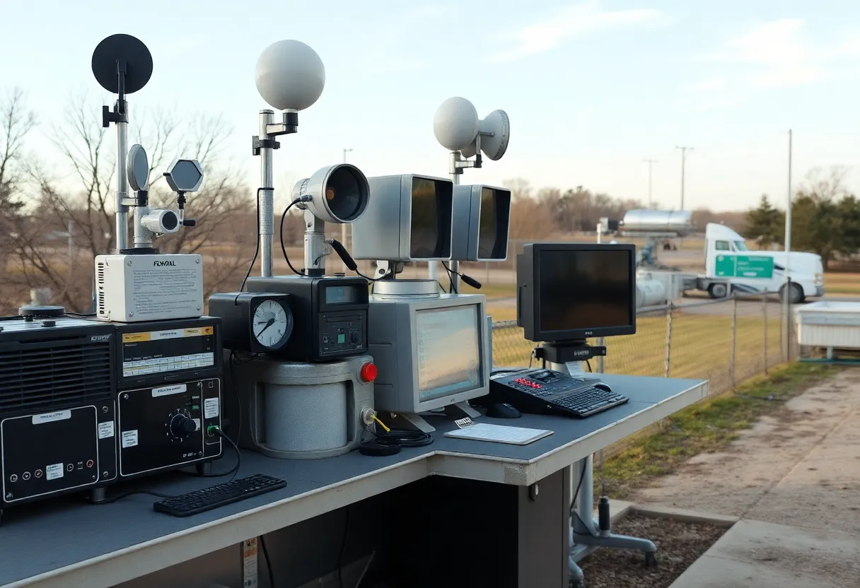
Texas’s forecasting network has come under scrutiny after the deadly flood that resulted in 137 fatalities. Critics point to gaps in observational data and physical monitoring infrastructure as factors that weaken short-term forecasting and flood-warning capability. One highlighted weakness is the presence of only a single upper air observation station along the roughly 700-mile Texas–Mexico border, which experts describe as insufficient to monitor weather impacts for a population exceeding 31 million people.
To address these gaps, experts have proposed the creation of a Texas weather prediction center focused on improving short-term forecasting, integrating data from flood gauges and meteorological instruments, and coordinating warnings for flash flooding and other severe events. The center would aim to provide more precise forecasts and faster public alerts to reduce loss of life and property in future events.
Legislative response: Proposed Senate Bill 1
Senate Bill 1, filed by Sen. Charles Perry, would establish a work group tasked with outlining a statewide system of flood gauges and meteorological equipment. The bill would require the work group to deliver a report by December 2026, detailing recommended deployments, technical standards and potential funding mechanisms. Supporters of immediate action emphasize that planning alone is not sufficient and that implementation of improved technologies and data collection should occur well before the next major flooding event.
Background and why changes matter
Upper air observations and dense surface networks are critical for identifying the structure of storms, predicting heavy rainfall rates, and issuing timely flash flood warnings. The recent fatal flood highlighted delays and uncertainties in forecasting and raised public debate about investment priorities. With more frequent extreme events, state and local officials face pressure to close data gaps, expand monitoring along international borders and coastal zones, and improve coordination among local governments, emergency managers and meteorological agencies.
| Key Feature | Description | Timeline/Status |
|---|---|---|
| Upper air observations | Currently only one station along 700-mile border; considered insufficient for statewide needs | Under review |
| Statewide flood gauge network | Proposed system to improve river and flash flood monitoring across Texas | Work group to be formed under SB1 |
| Texas weather prediction center | Expert proposal for a dedicated short-term forecasting and warning center | Advocated by meteorologists and safety officials |
| Reporting deadline | Work group report on recommended systems and standards | Due December 2026 |
Timeline of recent and forthcoming events
| Date/Time | Event | Status / Source |
|---|---|---|
| Next 48 hours | Weak cold front moves south across North Texas; cooler afternoons and scattered showers | Forecast advisory |
| Ongoing | Increased chances of thunderstorms; marginal risk for excessive rainfall and minor flooding | Weather outlook |
| Recent | Devastating flood resulting in 137 deaths; prompted scrutiny of forecasting systems | State incident reports |
| Current session | Senate Bill 1 proposed to form work group for statewide network | Legislative filing |
| December 2026 | Work group report due | SB1 requirement |
Simple visual statistics
Population potentially affected per current upper air station:
Forecast risk visualization (qualitative):
FAQ
What weather changes are expected in Texas in the next 48 hours?
A weak cold front will sag southward across North Texas over the next 48 hours, producing cloud cover and scattered rain showers. No sharp temperature drop is forecast. Morning lows will range from the low 70s in North Texas to the middle or upper 70s in South Texas, with afternoon highs near the low 90s in the north and middle to upper 90s in the south.
Is there a risk of flooding or severe storms?
There are increased chances of thunderstorms statewide with a marginal risk for excessive rainfall in some areas and a possibility of minor flooding. Emergency managers advise monitoring local forecasts and being prepared for localized heavy rainfall.
What prompted calls for better forecasting in Texas?
A recent devastating flood that caused 137 fatalities highlighted gaps in data collection and forecasting infrastructure, prompting experts and lawmakers to call for expanded monitoring and improved short-term forecast capabilities.
What does Senate Bill 1 propose?
Senate Bill 1 would create a work group to recommend a statewide system of flood gauges and meteorological equipment, and requires a report by December 2026 outlining proposed deployments, standards and funding considerations.
What specific technical gaps were identified?
One notable gap is that there is currently only one upper air observation station along the 700-mile Texas–Mexico border, which experts say is insufficient to monitor storms affecting more than 31 million residents. Additional surface and upper-air observations are being recommended.
Deeper Dive: News & Info About This Topic
HERE Resources
Increased Rain Chances and Flooding Risks Across Texas
University Research Highlights the Dangers of Flash Flooding in Kerr County
Candlelight Vigil in San Antonio for Flood Victims
Devastating Flash Flooding Claims Lives in Texas Hill Country
Catastrophic Flooding in Central Texas Claims Lives
Severe Flooding in San Antonio Leaves at Least 11 Dead
Concerns Rise Over Immigration and Healthcare in Texas
Severe Thunderstorm Watch Issued for San Antonio Area
San Antonio Faces Severe Heat and Thunderstorm Alerts
San Antonio Faces Extreme Heat Wave and Legislative Changes
Additional Resources
- Weather.com: The Colony, TX Weather
- Wikipedia: Texas
- Houston Chronicle: Central Texas Flood
- Google Search: Texas Weather Forecast
- Texas Storm Chasers: Storm Update
- Google Scholar: Texas Flooding
- KHOU: Houston Forecast
- Encyclopedia Britannica: Texas Climate
- Weather.com: The Woodlands, TX Weather
- Google News: Texas Weather News

Author: STAFF HERE SAN ANTONIO WRITER
The SAN ANTONIO STAFF WRITER represents the experienced team at HERESanAntonio.com, your go-to source for actionable local news and information in San Antonio, Bexar County, and beyond. Specializing in "news you can use," we cover essential topics like product reviews for personal and business needs, local business directories, politics, real estate trends, neighborhood insights, and state news affecting the area—with deep expertise drawn from years of dedicated reporting and strong community input, including local press releases and business updates. We deliver top reporting on high-value events such as Fiesta San Antonio, San Antonio Stock Show & Rodeo, and Dia de los Muertos. Our coverage extends to key organizations like the Greater San Antonio Chamber of Commerce and United Way of San Antonio and Bexar County, plus leading businesses in retail, insurance, and energy that power the local economy such as H-E-B, USAA, and Valero Energy. As part of the broader HERE network, including HEREAustinTX.com, HERECollegeStation.com, HEREDallas.com, and HEREHouston.com, we provide comprehensive, credible insights into Texas's dynamic landscape.