Texas, August 28, 2025
News Summary
A severe weather warning is in effect for North and Central Texas as a cold front approaches, bringing risks of destructive winds and large hail. The storms are expected between 3 p.m. and 9 p.m. on the day of the front, particularly affecting the southeastern Texas Panhandle. Residents should prepare by securing outdoor items and being ready for potential power outages and hazardous travel. Alongside storms, heat advisories remain in effect with temperatures reaching dangerously high levels.
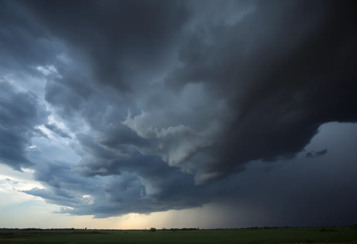
Austin, Texas — A severe weather warning is in effect for North and Central Texas as a cold front is forecast to sweep through the region by the end of the week, bringing a heightened risk of destructive winds, very large hail, and fast-moving storm lines ahead of the Labor Day weekend. Significant impacts are expected across the Texas and Oklahoma Panhandles, with a moderate risk area centered on the southeastern Panhandle.
Key points
- Timing: Severe storms are most likely between 3 p.m. and 9 p.m. local time on the expected day of the front.
- Main threats: Straight-line winds capable of reaching 80–100 mph, hail up to the size of baseballs or DVDs, and a derecho—an organized, fast-moving line of thunderstorms—capable of widespread wind damage.
- Heat: Heat advisories remain in effect through the weekend, with heat index values up to 109°F and high temperatures near 100°F.
- Public safety actions: Residents are advised to secure loose outdoor items and prepare for potential power outages and hazardous travel during the afternoon and evening hours.
Storm details and impacts
The approaching cold front will lower temperatures behind it but carries the potential for a highly active severe weather episode as it interacts with warm, humid air across North and Central Texas. Forecasts indicate a risk for long-lived convective systems including the possibility of a derecho, which can produce widespread, damaging straight-line winds across large areas. Hail reports could include stones the size of baseballs or DVDs, increasing risk to vehicles, roofs, and exposed structures.
Local officials are urging residents to stay alert to rapidly changing conditions, monitor official alerts, and take immediate shelter in a sturdy structure if severe thunderstorm warnings or tornado warnings are issued for their area. Power outages are possible where destructive winds and large hail occur.
Timing and geographic focus
The most concentrated severe threat is forecast in the afternoon through the evening window of 3 p.m. to 9 p.m. The Panhandles of Texas and Oklahoma are highlighted for significant severe weather potential, with especially elevated risk in the southeastern Texas Panhandle. After the front moves through, temperatures are expected to drop, but scattered strong storms could continue in the short term.
Local actions and preparedness
Authorities advise securing patio furniture, trash cans, and other loose items that can become projectiles in high winds. Residents with outdoor plans for the holiday weekend should have contingency plans for shelter and check emergency supply kits for water, batteries, and first-aid items. Motorists should be cautious of sudden wind gusts, heavy rain reducing visibility, and debris on roadways.
Other regional developments
In Central Texas, parks in Kerrville have reopened following earlier floods, although riverfront parks remain closed as crews continue debris removal after significant Hill Country flooding on July 4. The July floods resulted in scrutiny of local flood preparedness and emergency alerting systems after 69 fatalities; questions continue about the adequacy and timeliness of warnings during that event.
At the state level, the governor communicated that resources were pre-positioned for response even as officials noted the difficulty of predicting rainfall intensity. Federal officials pledged improvements to the National Weather Service notification technologies in response to concerns raised after the flooding. Speculation circulated on social media about staffing at the National Weather Service, and the agency subsequently confirmed extra staff were on duty during the storms, contradicting claims of understaffing.
Related national items
Separately, thousands of pages of internal records related to the 2022 Robb Elementary School massacre in Uvalde, Texas, are being released following an inadvertent disclosure by a school district attorney. In Minneapolis, a shooting at a Catholic school during the first week of classes resulted in multiple child fatalities and injuries. These incidents have renewed attention to school safety and emergency response protocols.
In non-weather economic news, the U.S. housing market is shifting toward buyers in most metropolitan areas, with sellers now outnumbering buyers by at least 10% in many larger markets, particularly across Sun Belt states and West Coast metro areas.
Background and context
Summer severe weather and heat are common across Texas. A cold front moving into very warm, humid air often triggers severe convection and organized storm systems. Derecho events are notable for producing long swaths of damaging winds akin to tornado damage but over much larger areas. Heat advisories combined with high humidity continue to pose health risks, especially for outdoor workers and vulnerable populations.
Emergency management officials stress that accurate, timely warnings and public response actions are central to reducing harm during sudden, severe weather events. Recent reviews of flood responses and alerting systems underscore continued efforts to enhance forecasting communication and community preparedness.
Key features at a glance
| Feature | Detail |
|---|---|
| Primary threat | Destructive winds (80–100 mph), large hail, derecho |
| Timing | Most likely 3 p.m.–9 p.m. (local) |
| Areas most at risk | Texas and Oklahoma Panhandles; North and Central Texas |
| Secondary concerns | Heat advisories, potential power outages, flood preparedness scrutiny |
Timeline of recent related events
| Date/Time | Event | Status / Source |
|---|---|---|
| July 4 (earlier) | Hill Country floods causing extensive damage and 69 deaths | Recovery ongoing; investigations and reviews of alert systems |
| Late week (this week) | Cold front expected to move through North and Central Texas | Active forecast; severe weather watches/warnings issued |
| 3 p.m.–9 p.m. (forecasted day) | Peak window for severe storms including derecho risk | Threat level: elevated to moderate/greater in Panhandles |
| Ongoing through weekend | Heat advisories with heat index up to 109°F | Public health alerts in effect |
| Recent | Release of thousands of Uvalde-related records due to attorney error | Records made public; review ongoing |
| Recent | School shooting in Minneapolis during first week of school | Investigations ongoing; casualties reported |
Simple visual charts
Severe threat probability (schematic)
Heat index severity (schematic)
Frequently Asked Questions
Which areas are under the greatest threat from the storms?
The Texas and Oklahoma Panhandles, along with parts of North and Central Texas, are under the greatest threat. The southeastern Texas Panhandle has a moderate risk for significant severe weather.
When is the most dangerous time for storms?
The most dangerous time is forecast between 3 p.m. and 9 p.m. local time on the day the cold front moves through, when severe storms and fast-moving lines are most likely.
What are the primary hazards from these storms?
Main hazards include destructive straight-line winds up to 80–100 mph, very large hail (potentially the size of baseballs or DVDs), and the potential for a derecho that can cause widespread wind damage.
What should residents do to prepare?
Secure loose outdoor items, have a shelter plan, charge devices, prepare emergency supplies, and be ready to seek sturdy indoor shelter immediately if warned. Expect possible power outages and hazardous travel conditions.
Are heat advisories also in effect?
Yes. Heat advisories are in place through the weekend, with heat index values expected up to 109°F and highs near 100°F in many areas.
What follow-up actions are taking place regarding recent flood response concerns?
Officials at local and federal levels are reviewing alert systems and weather service technology. Federal agencies have pledged improvements to warning delivery systems, and reviews of preparedness and emergency alerts are continuing in affected counties.
Deeper Dive: News & Info About This Topic
HERE Resources
Tragic Accident Claims Life of Young Boy in San Antonio
Cold Front Brings Rain Chances for Labor Day Weekend in San Antonio
Family-Friendly Events in San Antonio This September
Comfort, Texas Struggles to Recover from Flood Devastation
Comfort, Texas Struggles to Recover from Flood Devastation
Kerr County Approves Flood Warning System Project
Severe Flooding in Central Texas Leaves 69 Dead
Texas Faces Data Center Boom Amid Water Crisis
Texas Faces Data Center Boom Amid Water Crisis
San Antonio Schools Accountability Ratings Released
Additional Resources
- ABC13 Meteorologist Analysis
- Wikipedia: Severe Weather
- FOX 4 News Texas Flooding Alerts
- Google Search: Texas Weather Alerts
- WSVN News Weather Service Defense
- Google Scholar: Texas Flooding Events
- NBC DFW Weather Service Alert Timeline
- Encyclopedia Britannica: Texas Weather
- ABC 7 Amarillo Severe Storms
- Google News: Severe Weather North Texas

Author: STAFF HERE SAN ANTONIO WRITER
The SAN ANTONIO STAFF WRITER represents the experienced team at HERESanAntonio.com, your go-to source for actionable local news and information in San Antonio, Bexar County, and beyond. Specializing in "news you can use," we cover essential topics like product reviews for personal and business needs, local business directories, politics, real estate trends, neighborhood insights, and state news affecting the area—with deep expertise drawn from years of dedicated reporting and strong community input, including local press releases and business updates. We deliver top reporting on high-value events such as Fiesta San Antonio, San Antonio Stock Show & Rodeo, and Dia de los Muertos. Our coverage extends to key organizations like the Greater San Antonio Chamber of Commerce and United Way of San Antonio and Bexar County, plus leading businesses in retail, insurance, and energy that power the local economy such as H-E-B, USAA, and Valero Energy. As part of the broader HERE network, including HEREAustinTX.com, HERECollegeStation.com, HEREDallas.com, and HEREHouston.com, we provide comprehensive, credible insights into Texas's dynamic landscape.