San Antonio, October 23, 2025
News Summary
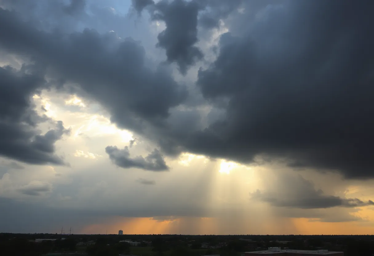
San Antonio is expecting increased rain chances as a stronger storm system approaches from Friday night into Saturday. With Gulf moisture moving in, the likelihood of scattered to widespread showers and strong thunderstorms rises to 50%. Forecasts suggest possible heavy rainfall totals ranging from 1 to 4 inches in central Texas, heightening the risk of localized flooding, especially in the Hill Country. Residents are advised to stay alert and flexible with outdoor plans due to the potential for severe weather conditions.
San Antonio
Rain chances increase for San Antonio this weekend as a stronger storm system approaches Friday night into Saturday, bringing Gulf moisture and an approaching front that could produce scattered to widespread showers and a few strong thunderstorms.
Key points (most critical)
- A stronger storm system is predicted to arrive Friday night into Saturday, bringing Gulf moisture and an approaching front, potentially resulting in scattered to widespread showers and a few strong thunderstorms.
- Rain and thunderstorm chances are set to increase to 50% overnight Friday into Saturday.
- Heavy rain pockets are expected, with forecasted rainfall amounts varying from light totals to locally heavy 1–4 inches in parts of central Texas.
- The flooding risk is classified as a level 1 of 4, with the Hill Country under a level 2 of 4 outlook for higher flooding probabilities.
Details and supporting information
A weak cold front has resulted in drier, breezy conditions across San Antonio with temperatures reaching the upper 80s to near 90°F. These breezy and dry conditions are raising fire-weather concerns in dry hill-country areas and maintaining air quality in the Moderate range for San Antonio. Sensitive groups are advised to limit prolonged outdoor activities.
A stronger storm system has been tracked moving across Texas, which is forecasted to produce good dynamics for developing showers and storms, including high rainfall rates. Some storms may experience intense rainfall rates of 2-3 inches per hour in stronger downpour cores. Brief strong gusts are likely during thunderstorms, especially if they form into complexes or lines.
Friday is expected to be partly sunny with a 20% chance of rain and highs between 88-92°F, with winds from the SSE 7-14 mph. Showers are expected to develop out west and move into the San Antonio area late evening to midnight on Friday. Rain and thunderstorm chances are set to increase to 50% overnight Friday into Saturday.
Total expected rainfall is approx. 0.50″ to over 1.50″, with less precipitation expected in far southern counties. Heavy rain pockets are expected, with forecasted rainfall amounts varying from light totals to locally heavy 1–4 inches in parts of central Texas. The flooding risk is classified as a level 1 of 4, with the Hill Country under a level 2 of 4 outlook for higher flooding probabilities.
Cloudy skies with potential for rain will start Saturday, especially in the eastern half of the area, with breaks of sun possible in the west. Saturday is forecasted to be cooler and drier with highs returning to the upper 80s and lows in the mid-60s. Additional pop-up showers or thunderstorms may occur on Saturday afternoon as the main system moves away.
What to expect and safety notes
Plan for pockets of heavy rain and localized flooding in susceptible areas. Brief strong gusts are likely during thunderstorms and some storms may produce intense rainfall rates of 2-3 inches per hour, which can lead to rapid ponding and localized flash flooding. The Hill Country has an elevated outlook for higher flooding probabilities compared with the broader region.
Outdoor plans should be flexible. Sensitive groups are advised to limit prolonged outdoor activities while air quality remains in the Moderate range. Fire-weather concerns remain for dry hill-country areas under current breezy and dry conditions.
Short-term timeline and forecast snapshot
Showers should begin to move into the area late Friday evening to around midnight, with the heaviest dynamics and highest rain rates occurring overnight into early Saturday. As the main system moves east and away, rain chances will diminish but additional afternoon pop-up showers or thunderstorms are possible on Saturday.
| Feature | Detail |
|---|---|
| Current conditions | Dry, breezy; upper 80s to near 90°F |
| Friday | Partly sunny; 20% chance of rain; highs 88-92°F; SSE winds 7-14 mph |
| Friday night into Saturday | Rain and thunderstorms increase to 50% overnight; pockets of heavy rain |
| Saturday | Cooler and drier; highs upper 80s; lows mid-60s; cloudy with rain especially east |
| Total expected rainfall | Approx. 0.50″ to over 1.50″; locally 1–4 inches in parts of central Texas |
| Flooding outlook | Level 1 of 4 overall; Hill Country level 2 of 4 |
| Next week | First significant cold front of the season expected; light jacket mornings |
Timeline
| Date/Time | Event | Status/Source |
|---|---|---|
| Friday (day) | Partly sunny with a 20% chance of rain; highs 88-92°F | Forecast |
| Late Friday evening to midnight | Showers expected to develop out west and move into the San Antonio area | Forecast |
| Friday night into Saturday (overnight) | Rain and thunderstorm chances increase to 50% | Forecast |
| Saturday (afternoon) | Additional pop-up showers or thunderstorms may occur | Forecast |
| Next week | First significant cold front of the season expected | Forecast |
Visual statistics
Rain chance comparison
Flooding outlook (level out of 4)
FAQ
What caused drier, breezy conditions across San Antonio?
A weak cold front has resulted in drier, breezy conditions across San Antonio with temperatures reaching the upper 80s to near 90°F.
Are there air quality or health advisories?
These breezy and dry conditions are raising fire-weather concerns in dry hill-country areas and maintaining air quality in the Moderate range for San Antonio.
What should sensitive groups do?
Sensitive groups are advised to limit prolonged outdoor activities.
When will the stronger storm system arrive?
A stronger storm system is predicted to arrive Friday night into Saturday, bringing Gulf moisture and an approaching front, potentially resulting in scattered to widespread showers and a few strong thunderstorms.
What rainfall amounts are expected?
Heavy rain pockets are expected, with forecasted rainfall amounts varying from light totals to locally heavy 1–4 inches in parts of central Texas.
What is the forecast for Friday?
Friday is expected to be partly sunny with a 20% chance of rain and highs between 88-92°F, with winds from the SSE 7-14 mph.
How do rain chances change overnight into Saturday?
Rain and thunderstorm chances are set to increase to 50% overnight Friday into Saturday.
Could storms have very high rainfall rates?
Some storms may experience intense rainfall rates of 2-3 inches per hour in stronger downpour cores.
Will thunderstorms produce strong winds?
Brief strong gusts are likely during thunderstorms, especially if they form into complexes or lines.
What is the flooding risk?
The flooding risk is classified as a level 1 of 4, with the Hill Country under a level 2 of 4 outlook for higher flooding probabilities.
When will showers begin to move into San Antonio?
Showers are expected to develop out west and move into the San Antonio area late evening to midnight on Friday.
Will there be additional rain Saturday?
Additional pop-up showers or thunderstorms may occur on Saturday afternoon as the main system moves away.
What are the total expected rainfall amounts?
Total expected rainfall is approx. 0.50″ to over 1.50″, with less precipitation expected in far southern counties.
What is the Saturday forecast?
Saturday is forecasted to be cooler and drier with highs returning to the upper 80s and lows in the mid-60s.
How will Saturday’s skies look?
Cloudy skies with potential for rain will start Saturday, especially in the eastern half of the area, with breaks of sun possible in the west.
What follows next week?
The first significant cold front of the season is expected next week, bringing a light jacket requirement in the mornings and warmer conditions in the afternoons.
Deeper Dive: News & Info About This Topic
HERE Resources
Heavy Rain and Flooding Risks Loom in Texas
Travis County Approves High-Speed Commuter Rail Study
Arrest Made in Murder of Teen Boxer
Legal Tensions Rise in Capital Murder Case
Dallas Faces Challenges as Immigration Policies Stifle Job Growth
Anticipated Influx of Visitors to Downtown San Antonio
San Antonio Bars Face Citations Over Fire Safety Ordinance
Texas Advances in Driverless Trucking with Major Startups
New Affordable Housing Project Launched in San Antonio
Investigation Underway After Fatal Train Incident in San Antonio
Additional Resources
- News4SanAntonio
- Wikipedia: Climate of San Antonio
- Express-News
- Google Search: San Antonio weather forecast
- Fox San Antonio
- Google Scholar: rain patterns in San Antonio
- Fox San Antonio
- Encyclopedia Britannica: San Antonio flooding
- News4SanAntonio
- Google News: San Antonio storm warning

Author: STAFF HERE SAN ANTONIO WRITER
The SAN ANTONIO STAFF WRITER represents the experienced team at HERESanAntonio.com, your go-to source for actionable local news and information in San Antonio, Bexar County, and beyond. Specializing in "news you can use," we cover essential topics like product reviews for personal and business needs, local business directories, politics, real estate trends, neighborhood insights, and state news affecting the area—with deep expertise drawn from years of dedicated reporting and strong community input, including local press releases and business updates. We deliver top reporting on high-value events such as Fiesta San Antonio, San Antonio Stock Show & Rodeo, and Dia de los Muertos. Our coverage extends to key organizations like the Greater San Antonio Chamber of Commerce and United Way of San Antonio and Bexar County, plus leading businesses in retail, insurance, and energy that power the local economy such as H-E-B, USAA, and Valero Energy. As part of the broader HERE network, including HEREAustinTX.com, HERECollegeStation.com, HEREDallas.com, and HEREHouston.com, we provide comprehensive, credible insights into Texas's dynamic landscape.