San Antonio, August 19, 2025
News Summary
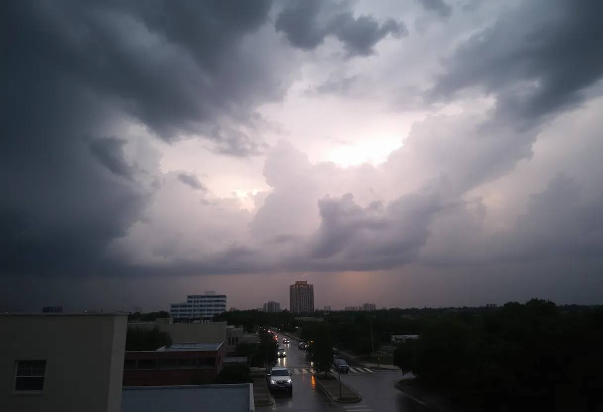
San Antonio is bracing for increased rain activity and possible flooding this week as a weather system moves in. With showers and thunderstorms expected, residents are warned to stay vigilant for local flash flooding, especially in low-lying areas. The National Weather Service has issued a marginal risk for excessive rainfall, particularly from Wednesday to Saturday. Rainfall could accumulate up to 2 inches, making it essential for individuals to remain prepared as humidity and temperature shifts are anticipated.
San Antonio Faces Increased Rain Chances and Possible Flooding This Week as Weather System Moves In
San Antonio is set to experience heightened rain activity and the potential for flooding this week as a weather system approaches the region. Starting this afternoon, residents can expect showers and thunderstorms that may lead to local flash flooding.
The National Weather Service has placed much of Texas, including San Antonio, under a marginal risk for excessive rainfall on Wednesday and Thursday. This situation necessitates that individuals remain vigilant about changing weather conditions, especially as isolated flooding could occur in low-lying or poorly drained areas.
In advance of these weather changes, temperatures are anticipated to decrease slightly to the low and mid-90s later in the week. However, the increased likelihood of rain could create a significant contrast in temperature perceived by residents, particularly due to the accompanying humidity.
Detailed Forecast
Strong to severe thunderstorms are expected late Friday into Saturday, particularly from 3 a.m. to 10 a.m. on Saturday morning. An incoming weak tropical disturbance will facilitate the influx of moisture into Texas, which will lead to scattered showers and potential storms throughout the area.
The rain coverage for Saturday morning is likely to reach around 30-40%, with localized rainfall possibly accumulating up to 1-2 inches in regions such as Medina, Bandera, and Kerr counties. By midday on Saturday, the chances for rain are expected to diminish, although scattered showers or storms may still be possible until 4 p.m.
As the day progresses, afternoon temperatures are forecast to rise to approximately 96 degrees, although the humid conditions may make it feel like over 100 degrees. By evening, rain chances will drop below 10%, and temperatures will cool to the upper 80s after 8:30 p.m.
Looking to Sunday, temperatures are projected to rise swiftly, reaching around 90 degrees by 11 a.m., with a potential for hitting 100 degrees later in the afternoon. The chances for rain will be low on that day.
Mid-Week Weather Shifts
As the week progresses, a notable shift in weather patterns is anticipated. High pressure is expected to move into the western U.S., allowing for weak disturbances to increase rain chances to 20% by Tuesday and 30-40% for Wednesday and Thursday. The National Weather Service has also highlighted the potential for heavy rainfall and local flooding due to already saturated soils in the region.
August typically accounts for San Antonio’s third-driest month, with an average rainfall of 1.84 inches. Given recent drought conditions, any additional rainfall this week could have significant implications for the region.
Looking Ahead
This week’s forecast models suggest total rainfall accumulation may reach between one and two inches, with some isolated areas potentially receiving more due to high moisture levels. Residents are encouraged to stay informed and prepared as the weather evolves throughout the week.
FAQ
What weather changes are expected in San Antonio this week?
San Antonio is facing increased rain chances with potential thunderstorms and isolated flooding from Wednesday to Thursday. Temperatures are expected to decrease slightly due to these weather conditions.
San Antonio is facing increased rain chances with potential thunderstorms and isolated flooding from Wednesday to Thursday. Temperatures are expected to decrease slightly due to these weather conditions.
What are the expected rainfall amounts?
Forecast models predict total rainfall accumulation between one to two inches, with isolated areas possibly receiving more due to higher moisture levels.
Forecast models predict total rainfall accumulation between one to two inches, with isolated areas possibly receiving more due to higher moisture levels.
How might this rain affect local conditions?
The rain may alleviate some drought conditions in the area, but there is also a risk of local flooding due to already saturated soils, especially in low-lying areas.
The rain may alleviate some drought conditions in the area, but there is also a risk of local flooding due to already saturated soils, especially in low-lying areas.
When is the most active rain period expected?
The most active rain period is anticipated late Friday into Saturday morning, particularly from 3 a.m. to 10 a.m.
The most active rain period is anticipated late Friday into Saturday morning, particularly from 3 a.m. to 10 a.m.
Key Weather Features
| Feature | Details |
|---|---|
| Rain Chances | Increased chances from Wednesday to Saturday |
| Potential Rainfall | 1 to 2 inches expected |
| Temperature Range | Low and mid-90s |
| Severe Thunderstorm Risk | Late Friday into Saturday |
| Humidity Impact | Feels like temperatures over 100 degrees |
Deeper Dive: News & Info About This Topic
HERE Resources
Severe Flash Flooding in San Antonio Claims Lives
SAISD Faces HVAC Challenges Impacting Student Comfort
Industrial Fire at Meyer MT Texas in San Antonio
Hurricane Erin Weakens to Category 3: Impact Spreads Across the Caribbean
Texas Education Agency Releases Accountability Ratings for San Antonio Schools
Tropical Moisture Brings Flood Concerns to San Antonio
Drone Delivery Takes Flight in Texas
Historic Flooding Sweeps Through Milwaukee with Over 12 Inches of Rainfall
Colorado Wildfires Cause Prison Evacuations and Air Quality Woes
Latest Updates on the Lee and Elk Fires in Western Colorado
Additional Resources
- San Antonio Express-News
- Wikipedia: San Antonio
- KSAT
- Google Search: San Antonio weather forecast
- KENS 5
- Google Scholar: Texas rain predictions
- The Weather Channel
- Encyclopedia Britannica: San Antonio
- San Antonio Express-News
- Google News: San Antonio flooding forecast

Author: STAFF HERE SAN ANTONIO WRITER
The SAN ANTONIO STAFF WRITER represents the experienced team at HERESanAntonio.com, your go-to source for actionable local news and information in San Antonio, Bexar County, and beyond. Specializing in "news you can use," we cover essential topics like product reviews for personal and business needs, local business directories, politics, real estate trends, neighborhood insights, and state news affecting the area—with deep expertise drawn from years of dedicated reporting and strong community input, including local press releases and business updates. We deliver top reporting on high-value events such as Fiesta San Antonio, San Antonio Stock Show & Rodeo, and Dia de los Muertos. Our coverage extends to key organizations like the Greater San Antonio Chamber of Commerce and United Way of San Antonio and Bexar County, plus leading businesses in retail, insurance, and energy that power the local economy such as H-E-B, USAA, and Valero Energy. As part of the broader HERE network, including HEREAustinTX.com, HERECollegeStation.com, HEREDallas.com, and HEREHouston.com, we provide comprehensive, credible insights into Texas's dynamic landscape.