San Antonio, August 30, 2025
News Summary
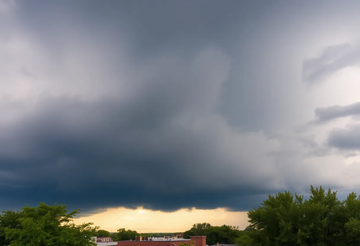
A cold front stalling north of San Antonio is set to cause hot temperatures and increase storm chances throughout South Texas this weekend. Isolated storms will start in the Hill Country on Saturday and drift south, with the intensity peaking from Sunday into early Monday. Localized heavy downpours could potentially lead to flash flooding, particularly in vulnerable areas.
San Antonio
A cold front is expected to stall north of San Antonio on Saturday, allowing hot temperatures to persist while increasing the chance for scattered storms across South Texas this weekend. Afternoon isolated storms should begin in the Hill Country and drift south toward San Antonio on Saturday, with the best chances for organized activity along and north of Interstate 10. Rain chances will increase through the weekend, with the highest intensity likely from Sunday into early Monday. Localized heavy downpours could lead to isolated flash flooding, particularly in the Hill Country and the southern Edwards Plateau.
Key impacts and timing
Storms are expected to be fueled by abundant moisture, producing afternoon and evening thunderstorms across the Hill Country, Edwards Plateau, and along the I-35 corridor. While widespread flooding is not expected, slow-moving storms and repeated heavy downpours could cause urban and small stream flooding. Forecasts call for rainfall amounts generally between 1 and 3 inches, with isolated higher totals possible in bands of persistent heavy rain. Forecasters have assigned a marginal flash flood risk (level 1 of 4) for parts of the region.
Timing highlights:
- Saturday afternoon: Cold front stalls north of the metro area; isolated storms start in the Hill Country and move south.
- Sunday into early Monday: Increased coverage and peak storm intensity, with the greatest potential for heavier downpours and localized flooding.
- Monday afternoon: Lingering rain possible; high temperatures expected to fall to near 90°F as drier air begins to work in.
Areas of greatest concern
The best storm chances are forecast along and north of I-10, across the Hill Country and southern Edwards Plateau. The I-35 corridor can also expect afternoon and evening thunderstorm activity. Urban locations, small streams, and low-lying areas are most vulnerable to localized flash flooding if storms repeatedly move over the same neighborhoods.
Forecast details and expected impacts
Forecasters anticipate continued hot conditions near the stalled front while showers and thunderstorms increase in coverage through the weekend. The expected rainfall range of 1–3 inches could produce isolated flash flooding where storms train or move slowly. The marginal (level 1 of 4) flood threat indicates caution for localized flooding pockets rather than a widespread flood emergency.
Residents should monitor changing conditions, plan for the possibility of brief heavy rainfall and localized flooding this weekend, and be prepared for storm-related hazards such as brief roadway inundation and localized ponding.
Context and background
Multiple regional meteorologists and weather reporters have been following the evolving situation and highlighting the potential for increased rain through the weekend. The meteorological setup combines a stalled frontal boundary near the area with abundant atmospheric moisture, which commonly produces afternoon and evening storms in this region during the warm season. Earlier in August, forecasters noted hot back-to-school conditions with limited rain chances; the upcoming weekend marks a shift toward greater rain potential.
In the broader Atlantic basin, the National Hurricane Center has reported potential development of a system named Hurricane Erin that is likely to affect parts of the eastern United States. That tropical system is separate from the local frontal pattern affecting South Texas this weekend, but it is part of the overall busy tropical season.
What residents should do
- Be alert for changing weather forecasts and any local advisories concerning heavy rain or flooding.
- Avoid driving through flooded roadways and be prepared for brief power or travel disruptions in areas with heavier storms.
- Expect hot temperatures to persist near the stalled front, with a cooldown toward near 90°F once rain and drier air arrive Monday.
FAQ
When will storms and rain chances be highest?
Isolated storms should begin Saturday afternoon in the Hill Country and move south. Rain chances increase through the weekend, with the peak intensity expected from Sunday into early Monday. Lingering rain is possible through Monday afternoon.
How much rain is expected?
Rainfall amounts are anticipated to be between 1 and 3 inches, with isolated higher totals possible in areas that receive repeated heavy downpours.
Is flash flooding likely?
There is a marginal flash flood risk (level 1 of 4) for parts of the region. Widespread flooding is not expected, but slow-moving storms and repetitive downpours could cause localized urban and small stream flooding.
Which areas are most at risk?
The Hill Country, southern Edwards Plateau, areas along and north of I-10, and the I-35 corridor face the greatest storm and heavy rain potential. Urban areas and small streams are most vulnerable to localized flooding.
How should residents prepare?
Monitor forecasts and weather alerts, avoid driving through flooded roadways, and be prepared for brief, localized impacts from heavy downpours such as roadway inundation and reduced visibility during storms.
Key features
| Feature | Detail |
|---|---|
| Stalled front location | North of San Antonio on Saturday |
| Primary at-risk areas | Hill Country, southern Edwards Plateau, along and north of I-10, I-35 corridor |
| Timing | Isolated storms Saturday afternoon; peak Sunday–early Monday; lingering Monday afternoon |
| Expected rainfall | 1–3 inches (localized heavier totals possible) |
| Flood risk | Marginal (level 1 of 4) — localized urban and small stream flooding possible |
Timeline
| Date / Time | Event | Status / Source |
|---|---|---|
| Saturday afternoon | Cold front stalls north of San Antonio; isolated storms begin in Hill Country and move south | Forecast |
| Sunday — early Monday | Increased coverage and peak storm intensity; highest rain potential | Forecast |
| Monday afternoon | Lingering rain possible; highs drop to near 90°F | Forecast |
| Ongoing (Atlantic) | Potential development of Hurricane Erin likely to affect eastern U.S. | National Hurricane Center |
Quick statistics
Deeper Dive: News & Info About This Topic
HERE Resources
San Antonio High School Students Arrested in Mass Shooting Conspiracy
San Antonio Students Arrested in Mass Shooting Plot
Labor Day Weekend: City Services Adjusted for Events
Severe Storms Threaten Texas Panhandle with High Winds and Flooding
Website Performance Issues: Space City Weather’s Hosting Challenges
Labor Day Weekend Events in San Antonio
New Orleans Residents Seek Refuge in Texas After Katrina
San Antonio Business Owners Disappointed by Recovery Fair
Texas Ten Commandments Law Faces Legal Challenge
San Antonio High Schools Recognized for Academic Excellence
Additional Resources
- KSAT Weather Update
- Wikipedia: Weather Forecasting
- KSAT Spotty Rain Forecast
- Google Search: San Antonio Weather Forecast
- KSAT Hurricane Harvey Memory
- Google Scholar: Hurricane Harvey Impact
- KSAT Weather Update
- Encyclopedia Britannica: Texas Weather
- KSAT San Antonio Week
- Google News: San Antonio Weather

Author: STAFF HERE SAN ANTONIO WRITER
The SAN ANTONIO STAFF WRITER represents the experienced team at HERESanAntonio.com, your go-to source for actionable local news and information in San Antonio, Bexar County, and beyond. Specializing in "news you can use," we cover essential topics like product reviews for personal and business needs, local business directories, politics, real estate trends, neighborhood insights, and state news affecting the area—with deep expertise drawn from years of dedicated reporting and strong community input, including local press releases and business updates. We deliver top reporting on high-value events such as Fiesta San Antonio, San Antonio Stock Show & Rodeo, and Dia de los Muertos. Our coverage extends to key organizations like the Greater San Antonio Chamber of Commerce and United Way of San Antonio and Bexar County, plus leading businesses in retail, insurance, and energy that power the local economy such as H-E-B, USAA, and Valero Energy. As part of the broader HERE network, including HEREAustinTX.com, HERECollegeStation.com, HEREDallas.com, and HEREHouston.com, we provide comprehensive, credible insights into Texas's dynamic landscape.