San Antonio, October 25, 2025
News Summary
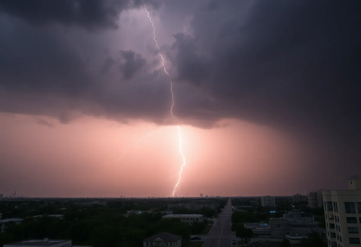
San Antonio is under a Severe Thunderstorm Watch until Saturday morning and a Flood Watch until Saturday afternoon. Heavy rainfall is expected, leading to potential flash flooding, particularly in the Canyon Lake area. Reports indicate storm damage and a tornado affecting homes. Emergency crews are on standby, and community organizations are preparing to assist vulnerable populations. A severe weather risk level of 2 out of 5 is forecasted for the region, with additional storms expected through the weekend.
San Antonio
A Severe Thunderstorm Watch is in effect until 3 am Saturday. A Flood Watch is in effect through 1 pm Saturday. Heavy rainfall is expected, which could lead to flash flooding. Storm damage reports are primarily coming from the Canyon Lake area. One person reported a tornado that severely damaged their home.
Immediate threat and watches
Emergency managers and meteorologists warn of multiple hazards this weekend, including severe thunderstorms, the potential for tornadoes, and flash flooding. A Severe Thunderstorm Watch is in effect until 3 am Saturday. A Flood Watch is in effect through 1 pm Saturday. Heavy rainfall is expected, which could lead to flash flooding.
Storm reports and impacts
Storm damage reports are primarily coming from the Canyon Lake area. One person reported a tornado that severely damaged their home. Emergency crews are preparing for possible severe weather threats and flash flooding, based on reports of deadly flooding earlier this summer. TDEM (Texas Division of Emergency Management) is monitoring the situation and has resources staged for response. TDEM has helicopters and swift water rescue teams on standby. The storm system has caused a physical response from emergency management agencies across the state.
Short-term forecast
On Saturday, there’s a 60% chance of rain with high temperatures between 82°F and 86°F. Variable winds are expected from the west at 5 to 10 mph. Scattered showers and thunderstorms are anticipated in the morning and part of the afternoon, with a mix of clouds and sun later in the day. On Sunday, partly sunny and warmer conditions are expected, with highs between 85°F and 89°F and winds from the north at 5 to 10 mph. Unseasonably hot weather is forecasted for Monday with highs between 89°F and 93°F and southeast winds at 5 to 10 mph. A strong cold front is anticipated to arrive on Tuesday.
Regional risk and rainfall
Additional severe weather is expected to impact west Texas and the southern Plains over the weekend, with tornado watches and warnings in effect. A level 2 out of 5 risk of severe storms is present in Texas and Louisiana for major cities like Austin, Houston, Lake Charles, and Baton Rouge on Saturday. Widespread rainfall of 1-3 inches is expected through Sunday, with localized amounts exceeding 3-5 inches in areas receiving repeated storms.
Preparedness and response
Businesses and non-profits in San Antonio are preparing for the storms, ensuring safety measures are in place. Haven for Hope will deploy outreach teams to warn the homeless population about the impending storms. TDEM (Texas Division of Emergency Management) is monitoring the situation and has resources staged for response. Emergency crews are preparing for possible severe weather threats and flash flooding, based on reports of deadly flooding earlier this summer. Leaders emphasize the importance of being prepared and having an emergency plan ready.
Background
Previous severe flooding incidents have led to loss of life and property in the San Antonio area. The forecast indicates continued storm development posing a heightened risk for severe weather and flash flooding across the region. Forecasters note that areas receiving repeated rounds of storms could see localized rainfall totals well above the widespread 1-3 inch expectation.
What to watch for
- Short-term watches: A Severe Thunderstorm Watch is in effect until 3 am Saturday. A Flood Watch is in effect through 1 pm Saturday.
- Rainfall: Heavy rainfall is expected, which could lead to flash flooding. Widespread rainfall of 1-3 inches is expected through Sunday, with localized amounts exceeding 3-5 inches in areas receiving repeated storms.
- Severe threats: Tornado risk is present; one person reported a tornado that severely damaged their home. Additional severe weather is expected to impact west Texas and the southern Plains over the weekend, with tornado watches and warnings in effect.
- Preparedness: TDEM (Texas Division of Emergency Management) is monitoring the situation and has resources staged for response. TDEM has helicopters and swift water rescue teams on standby. Haven for Hope will deploy outreach teams to warn the homeless population about the impending storms.
Key features
| Feature | Detail |
|---|---|
| Severe Thunderstorm Watch | A Severe Thunderstorm Watch is in effect until 3 am Saturday. |
| Flood Watch | A Flood Watch is in effect through 1 pm Saturday. |
| Rainfall forecast | Widespread rainfall of 1-3 inches is expected through Sunday, with localized amounts exceeding 3-5 inches in areas receiving repeated storms. |
| Severe risk level | A level 2 out of 5 risk of severe storms is present in Texas and Louisiana for major cities like Austin, Houston, Lake Charles, and Baton Rouge on Saturday. |
| Saturday forecast | 60% chance of rain; highs 82°F to 86°F; variable winds west 5 to 10 mph. |
| Sunday forecast | Partly sunny and warmer; highs 85°F to 89°F; north winds 5 to 10 mph. |
| Monday forecast | Unseasonably hot; highs 89°F to 93°F; southeast winds 5 to 10 mph. |
| Tuesday | A strong cold front is anticipated on Tuesday. |
Timeline
| Date/Time | Event | Status / Source |
|---|---|---|
| Through 3 am Saturday | Severe Thunderstorm Watch in effect | Watch active |
| Through 1 pm Saturday | Flood Watch in effect | Watch active |
| Saturday | 60% chance of rain; scattered showers and thunderstorms expected in the morning and part of the afternoon | Forecast |
| Sunday | Partly sunny and warmer conditions expected | Forecast |
| Monday | Unseasonably hot weather is forecasted | Forecast |
| Tuesday | A strong cold front is anticipated | Forecast |
| Earlier this summer | Previous severe flooding incidents have led to loss of life and property in the San Antonio area | Past impacts |
Quick charts
Rainfall expectation (visual):
Severe risk level (0-5):
FAQ
What watches are currently in effect?
A Severe Thunderstorm Watch is in effect until 3 am Saturday.
A Flood Watch is in effect through 1 pm Saturday.
What rainfall amounts are expected?
Heavy rainfall is expected, which could lead to flash flooding.
Widespread rainfall of 1-3 inches is expected through Sunday, with localized amounts exceeding 3-5 inches in areas receiving repeated storms.
Where are storm damage reports coming from and have tornadoes been reported?
Storm damage reports are primarily coming from the Canyon Lake area.
One person reported a tornado that severely damaged their home.
What is the near-term forecast for Saturday through Tuesday?
On Saturday, there’s a 60% chance of rain with high temperatures between 82°F and 86°F.
Variable winds are expected from the west at 5 to 10 mph.
Scattered showers and thunderstorms are anticipated in the morning and part of the afternoon, with a mix of clouds and sun later in the day.
On Sunday, partly sunny and warmer conditions are expected, with highs between 85°F and 89°F and winds from the north at 5 to 10 mph.
Unseasonably hot weather is forecasted for Monday with highs between 89°F and 93°F and southeast winds at 5 to 10 mph.
A strong cold front is anticipated to arrive on Tuesday.
How are emergency and community organizations responding?
Businesses and non-profits in San Antonio are preparing for the storms, ensuring safety measures are in place.
Haven for Hope will deploy outreach teams to warn the homeless population about the impending storms.
TDEM (Texas Division of Emergency Management) is monitoring the situation and has resources staged for response.
TDEM has helicopters and swift water rescue teams on standby.
Emergency crews are preparing for possible severe weather threats and flash flooding, based on reports of deadly flooding earlier this summer.
What regional risks beyond San Antonio are noted?
Additional severe weather is expected to impact west Texas and the southern Plains over the weekend, with tornado watches and warnings in effect.
A level 2 out of 5 risk of severe storms is present in Texas and Louisiana for major cities like Austin, Houston, Lake Charles, and Baton Rouge on Saturday.
Have past floods caused serious impacts in the area?
Previous severe flooding incidents have led to loss of life and property in the San Antonio area.
What are leaders advising now?
Leaders emphasize the importance of being prepared and having an emergency plan ready.
Deeper Dive: News & Info About This Topic
HERE Resources
Heavy Rain and Flooding Risks Loom in Texas
Severe Storms Threaten Texas Panhandle with High Winds and Flooding
Severe Weather Warning Issued for North and Central Texas
Severe Flooding in Central Texas Leaves 69 Dead
Over 30 Million Under Extreme Weather Alerts as Heat Wave Hits Western U.S.
Texas Confronts Weather Threats and Legislative Action
Increased Rain Chances and Flooding Risks Across Texas
San Antonio Faces Increased Rain Chances and Potential Flooding
Severe Flash Flooding in San Antonio Claims Lives
San Antonio, Texas Braces for Heatwave with Cold Front Ahead
Additional Resources
- Fox San Antonio
- Wikipedia: San Antonio Flooding
- News 4 San Antonio
- Google Search: San Antonio Thunderstorms
- San Antonio Express News
- Google Scholar: Flood Watch San Antonio
- KSAT News
- Encyclopedia Britannica: San Antonio Storms
- The Conversation
- Google News: San Antonio Severe Storms

Author: STAFF HERE SAN ANTONIO WRITER
The SAN ANTONIO STAFF WRITER represents the experienced team at HERESanAntonio.com, your go-to source for actionable local news and information in San Antonio, Bexar County, and beyond. Specializing in "news you can use," we cover essential topics like product reviews for personal and business needs, local business directories, politics, real estate trends, neighborhood insights, and state news affecting the area—with deep expertise drawn from years of dedicated reporting and strong community input, including local press releases and business updates. We deliver top reporting on high-value events such as Fiesta San Antonio, San Antonio Stock Show & Rodeo, and Dia de los Muertos. Our coverage extends to key organizations like the Greater San Antonio Chamber of Commerce and United Way of San Antonio and Bexar County, plus leading businesses in retail, insurance, and energy that power the local economy such as H-E-B, USAA, and Valero Energy. As part of the broader HERE network, including HEREAustinTX.com, HERECollegeStation.com, HEREDallas.com, and HEREHouston.com, we provide comprehensive, credible insights into Texas's dynamic landscape.