News Summary
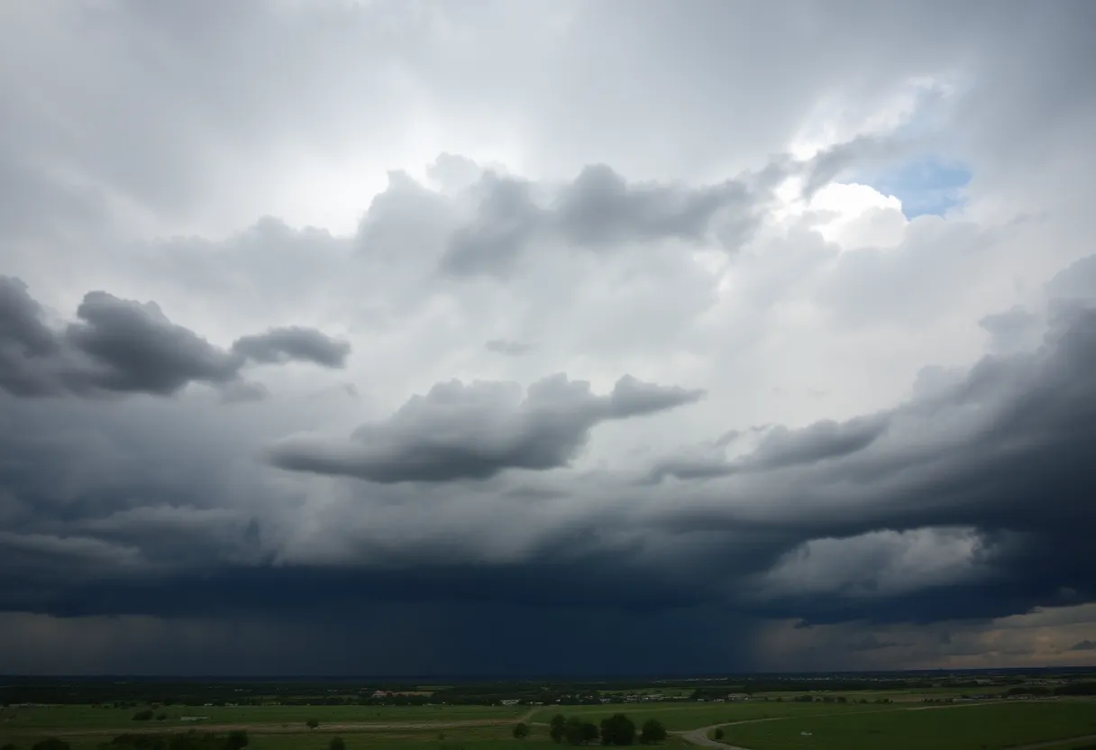
Central and South-Central Texas are under severe weather alerts following a night of intense storms. The National Weather Service warns of strong thunderstorms, flash floods, and the potential for tornadoes in the region. Residents are advised to prepare for hazardous conditions, including damaging winds and large hail. Flash flood warnings are in effect for several counties, and a tornado watch remains until late evening. Safety measures are being emphasized as strong storms are expected to persist throughout the day.
Severe Weather Alerts Across Central and South-Central Texas Following Stormy Night
Central and South-Central Texas are under severe weather alerts after a night marked by intense storms. The National Weather Service has issued advisories due to the likelihood of strong thunderstorms, flash floods, and even tornadoes in the region.
This morning, areas of fog are forecast to develop, but skies are expected to clear slightly to partly to mostly sunny conditions by lunchtime. However, as the day progresses into the evening, the weather may take a turn. Isolated showers and thunderstorms are projected, particularly across the Hill Country and areas west of Interstate 35.
As storms strengthen, they are anticipated to move eastward across the I-35 corridor into Central and South-Central Texas overnight, with a possibility of becoming strong to severe. Residents in the area should be alert for damaging winds and large hail associated with these storms. This means that caution is needed for those on the road as severe weather can make driving hazardous.
A flash flood warning is currently in effect for parts of Bexar, Comal, Guadalupe, and Hays counties until 3 a.m. Tuesday morning. Up to 2 inches of rain have already fallen in northern Bexar County, with forecasts indicating that an additional 1 to 3 inches could accumulate. This heavy rainfall poses a risk of flooding along creeks, streams, highways, streets, and at underpasses. Travelers are strongly advised against driving on flooded roadways, as conditions can change rapidly.
A tornado watch has been issued for numerous Texas counties, including Bexar, Comal, and Hays, and will remain in effect until 10 p.m. Monday. This indicates that weather conditions are favorable for the development of tornadoes. While earlier tornado warnings issued for specific counties, including Blanco and Hays, have since been canceled, residents should remain aware and prepared.
Strong to severe thunderstorms are expected to persist across the Hill Country throughout the evening and may reach the San Antonio metro region between 9 p.m. and 1 a.m. It is essential for residents to have a plan in place and to identify safe locations in the event that a tornado warning is issued.
Safety Measures
In preparing for potential severe weather, residents are encouraged to seek shelter in secure locations. The safest options include basements, designated storm shelters, or an interior closet or bathroom located at the lowest level of a home. Understanding nearby shelters ahead of time can save crucial minutes during emergency situations.
Looking Ahead
Despite the stormy conditions today, future weather forecasts predict a shift toward warmer temperatures and drier weather over the weekend, following the current storms. Residents are reminded to stay alert and monitor weather updates as the situation develops.
With severe weather on the horizon, Central and South-Central Texans should remain vigilant and prepared as conditions may change rapidly throughout the day and night.
Deeper Dive: News & Info About This Topic
HERE Resources
Severe Storms Devastate Austin, Causing Widespread Damage
Severe Weather and Community Events Expected in San Antonio
San Antonio Faces Severe Storms and Flooding Risks
San Antonio Experiences Severe Flooding Due to Heavy Rainfall
San Antonio Experiences Severe Flooding Due to Heavy Rainfall
Severe Thunderstorms Cause Chaos in Austin and San Antonio
San Antonio Breaks Rainfall Record Amid Drought Crisis
Severe Thunderstorms Cause Flash Flooding in San Antonio
Severe Thunderstorm Watch Issued for San Antonio Area
Severe Storms Bring Much-Needed Rain to San Antonio
Additional Resources
- Express News: Tornado Watch
- Wikipedia: Severe Weather
- KSAT: Air Quality Alerts
- Google Search: Air Quality in San Antonio
- News4SanAntonio: Thunderstorm Watch
- Google Scholar: Severe Thunderstorms
- KENS5: Road Closures Due to Storms
- Encyclopedia Britannica: Heavy Rain Safety
- Express News: Cold Front Forecast
- Google News: Cold Front Impact

Author: STAFF HERE SAN ANTONIO WRITER
The SAN ANTONIO STAFF WRITER represents the experienced team at HERESanAntonio.com, your go-to source for actionable local news and information in San Antonio, Bexar County, and beyond. Specializing in "news you can use," we cover essential topics like product reviews for personal and business needs, local business directories, politics, real estate trends, neighborhood insights, and state news affecting the area—with deep expertise drawn from years of dedicated reporting and strong community input, including local press releases and business updates. We deliver top reporting on high-value events such as Fiesta San Antonio, San Antonio Stock Show & Rodeo, and Dia de los Muertos. Our coverage extends to key organizations like the Greater San Antonio Chamber of Commerce and United Way of San Antonio and Bexar County, plus leading businesses in retail, insurance, and energy that power the local economy such as H-E-B, USAA, and Valero Energy. As part of the broader HERE network, including HEREAustinTX.com, HERECollegeStation.com, HEREDallas.com, and HEREHouston.com, we provide comprehensive, credible insights into Texas's dynamic landscape.