San Antonio, TX, August 19, 2025
News Summary
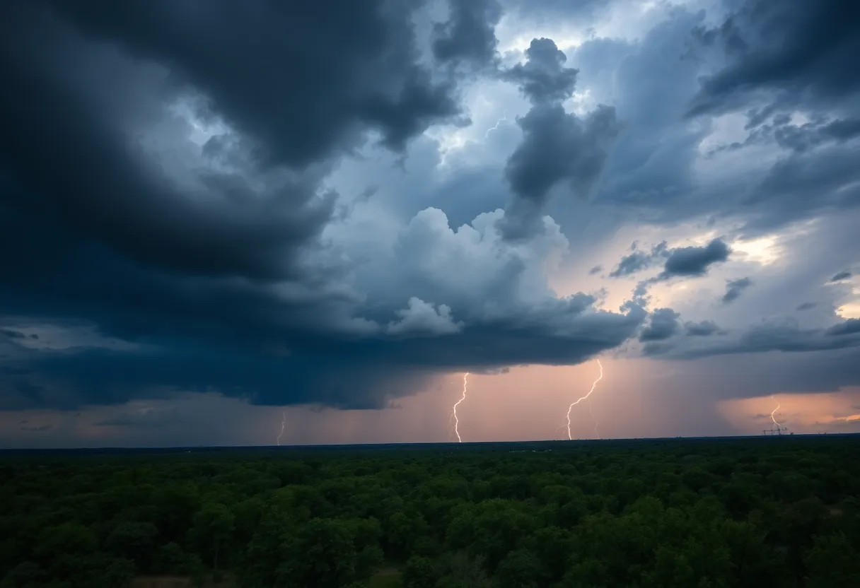
This week, much of Texas, including San Antonio, is expecting increased chances of rain and thunderstorms due to a high-pressure ridge shift. Starting Tuesday, scattered showers and storms will develop, raising the risk of localized flooding, especially on Wednesday and Thursday. With temperatures nearing 100°F and high humidity, the heat index may reach dangerous levels. Although short-term rainfall may help drought conditions, significant relief will need sustained precipitation.
San Antonio — Increased rain chances and the potential for localized flooding are expected across much of Texas this week as a westward shift in high pressure allows daily chances of showers and thunderstorms beginning Tuesday and continuing through the weekend.
Key points (most important first)
- Daily rain and storm chances will return starting Tuesday, with scattered activity each afternoon and evening.
- Marginal risk for excessive rainfall covers much of Texas on Wednesday and Thursday, raising the possibility of localized flooding.
- Heat and humidity will accompany storms: Tuesday and Wednesday highs near 100°F with heat index values between 101–108°F at times.
- Soil saturation and minor flooding are possible after multiple days of rain, despite ongoing severe and extreme drought in parts of the region including Bexar County.
Details: timing, coverage and impacts
Monday will be seasonable and quiet across the region. Activity returns on Tuesday with scattered showers and thunderstorms expected to develop after lunch and last through the evening. Tuesday morning lows will be in the upper 70s, with highs climbing to the upper 90s to near 100 degrees. Increased humidity will push the heat index into the 101–103°F range.
Wednesday follows a similar pattern. Scattered showers and storms are forecast to develop after 1 p.m. and continue through sunset. Peak temperatures could again reach near 100°F, while elevated humidity may produce heat index values near 108°F, creating conditions that could prompt a heat advisory if verified.
A weak cold front is expected to move south into Texas on Thursday and will serve as a focus for additional showers and thunderstorms. The Storm Prediction Center currently classifies the state under a general thunderstorm threat, although individual storms may produce gusty winds up to 40 mph, frequent lightning, and locally heavy rainfall.
Forecast guidance and the National Weather Service highlight high precipitable water values and the potential for slow-moving or training rain cells, which can produce heavy downpours over the same locations. Forecast models suggest statewide rainfall totals of about 1 to 2 inches through the weekend, with isolated pockets possibly receiving higher amounts. Soil can become oversaturated after several days of rain, increasing the chance of minor or localized flooding.
Local drought and climatology
Despite the increased rain chances, San Antonio and Bexar County remain affected by severe and extreme drought. Approximately 61% of Bexar County is categorized in extreme drought, and nearly 38% is in severe drought. Historically, August is the third-driest month for San Antonio, averaging about 1.84 inches of rain. Recent rainfall totals have been less than a tenth of an inch, so the possible 1–2 inch accumulations this week could be a meaningful increase locally, though distribution may be uneven.
Safety and preparedness guidance
- Stay weather-aware each afternoon and evening this week for changing conditions and localized heavy rain.
- Be prepared for brief periods of gusty winds and lightning with storms.
- Monitor water pooling on roads and low-lying areas; avoid driving through flooded roadways.
- Heat and humidity will remain high, so take precautions if outdoors during peak afternoon heat; consider limiting exertion and stay hydrated.
Background and why this is happening
The shift of a dominant high-pressure ridge westward is allowing more humid Gulf moisture to move into Texas. With moisture around 150% of typical August levels, the atmosphere will be capable of producing heavy rain where storms stall or train over the same areas. A weak front later in the week will enhance lift and help organize additional storm activity. Forecast uncertainty remains in the exact placement and intensity of storms, which are driven by mesoscale features that models resolve differently.
FAQ
When will rain and storms begin?
Scattered showers and storms are expected to return starting Tuesday, generally developing after lunch and lasting into the evening. Activity is likely each afternoon and evening through the week.
How much rain is forecast?
Forecast models suggest widespread totals of about 1 to 2 inches through the weekend, with isolated areas possibly receiving higher amounts in slow-moving or training storms.
Is flooding likely?
There is a marginal risk for excessive rainfall on Wednesday and Thursday that could produce localized or minor flooding, especially where multiple storms pass over the same area and soils become saturated.
Will there still be heat?
Yes. Tuesday and Wednesday are expected to reach upper 90s to near 100°F with heat index values from about 101–103°F, and locally near 108°F on Wednesday if humidity and temperatures trend higher.
How does this affect the drought?
Despite the expected rains, San Antonio and Bexar County remain in severe to extreme drought. Short-term rainfall may ease conditions locally, but persistent drought in parts of the county means longer-term recovery will require sustained precipitation.
What should residents do?
Monitor developing forecasts and weather alerts, avoid driving through flooded roadways, take precautions against heat and humidity, and be prepared for brief periods of strong winds and lightning with storms.
Key features at a glance
| Feature | Details |
|---|---|
| Timing | Rain/storms returning Tuesday afternoon through the weekend; Wednesday–Thursday highest flood risk |
| Rainfall forecast | Widespread 1–2 inches possible through weekend; isolated higher totals where storms train |
| Heat | Highs near 100°F Tuesday–Wednesday; heat index 101–108°F |
| Severe weather threats | General thunderstorm threat; some storms could have 40 mph gusts, lightning, and heavy rain |
| Drought status | Bexar County: ~61% extreme drought, ~38% severe drought |
| Hydrologic concern | Minor/localized flooding possible due to oversaturated soils and training storms |
Timeline
| Date/Time | Event | Status / Source |
|---|---|---|
| Monday | Seasonable and quiet weather | Forecast guidance |
| Tuesday (after lunch–evening) | Scattered showers and thunderstorms begin; highs near 100°F; heat index 101–103°F | Forecast guidance |
| Wednesday (after 1 p.m.–sunset) | Scattered storms; marginal risk for excessive rainfall; possible heat index near 108°F | Storm Prediction Center / National Weather Service |
| Thursday | Weak cold front moves south; additional showers and storms possible | Forecast guidance |
| Through weekend | Moisture around 150% of August averages; continued storm chances; 1–2 in. likely | National Weather Service / forecast models |
What this means
For local residents, expect afternoon and evening storms several days this week. While many areas may only see brief, scattered downpours, some neighborhoods could experience heavier, slow-moving storms that produce localized flooding, especially where rain falls repeatedly in the same place. High humidity combined with near-100°F temperatures will make conditions feel hotter than the thermometer indicates, increasing heat-related stress for people working or exercising outdoors. Short-term rainfall may help ease very dry ground in places, but significant drought relief would require more sustained rain over weeks.
Limitations and uncertainties: Exact storm placement and intensity are difficult to predict more than a day in advance. Convective storms can produce highly variable rainfall amounts over small areas, so localized totals may be much higher or lower than model averages. Heat index calculations depend on observed humidity and temperature at the time storms develop, and advisories will depend on evolving conditions.
Deeper Dive: News & Info About This Topic
HERE Resources
San Antonio Faces Increased Rain Chances and Potential Flooding
Severe Flash Flooding in San Antonio Claims Lives
Texas Education Agency Releases Accountability Ratings for San Antonio Schools
San Antonio’s Economy Faces New Challenges Amid Growth Slowdown
Tropical Moisture Brings Flood Concerns to San Antonio
Texas Economic Growth Takes a Breather
Construction ERP Single Database Platform: A Comprehensive Guide for San Antonio Construction Businesses
Construction ERP Guide for San Antonio Businesses
Construction ERP Systems: Mobile Solutions for San Antonio Construction Firms
Construction ERP Systems: Critical Success Factors for San Antonio Contractors
Additional Resources
- Express News: San Antonio Weather
- Wikipedia: Hurricane
- KENS5: San Antonio Weather Forecast
- Google Search: Texas Storm
- Hoodline: San Antonio Heat and Storms
- Google Scholar: Drought in Texas
- KSAT: Weather Forecast
- Encyclopedia Britannica: Weather Forecasting
- KSAT: Rain Chances in Texas
- Google News: Texas Weather Update

Author: STAFF HERE SAN ANTONIO WRITER
The SAN ANTONIO STAFF WRITER represents the experienced team at HERESanAntonio.com, your go-to source for actionable local news and information in San Antonio, Bexar County, and beyond. Specializing in "news you can use," we cover essential topics like product reviews for personal and business needs, local business directories, politics, real estate trends, neighborhood insights, and state news affecting the area—with deep expertise drawn from years of dedicated reporting and strong community input, including local press releases and business updates. We deliver top reporting on high-value events such as Fiesta San Antonio, San Antonio Stock Show & Rodeo, and Dia de los Muertos. Our coverage extends to key organizations like the Greater San Antonio Chamber of Commerce and United Way of San Antonio and Bexar County, plus leading businesses in retail, insurance, and energy that power the local economy such as H-E-B, USAA, and Valero Energy. As part of the broader HERE network, including HEREAustinTX.com, HERECollegeStation.com, HEREDallas.com, and HEREHouston.com, we provide comprehensive, credible insights into Texas's dynamic landscape.